School of Natural Resources and Management
Centre for Water Engineering Management

Profile of Faculty
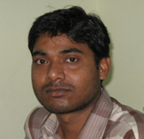
Mr. Birendra Bharti

Ph.D. Pursuing IIT Roorkee
M.Tech, Agricultural & Food Engg. Department, Water Resources Development & Management (WRD&M) IIT, Kharagpur

Assistant Professor
Centre for Water Engineering Management

E-Mail birendrabharti@gmail.com, birendra.bharti@cuj.ac.in

Area of Specialization   Hydrological Modeling, Remote Sensing and GIS Applications in Hydrology, Water Resources & Management,Application of Remote Sensing and GIS for water resources planning and management
Research Interest  
Application of Remote Sensing and GIS for water resources planning and management, Groundwater Hydrology, Irrigation Water Management.
Teaching  
  1. Modelling in Water Resources
  2. System Analysis Techniques
  3. Engineering Geology
  4. Engineering Mechanics
  5. Mechanics of Solids
  6. Thermodynamics
Membership of Professional Bodies   Life Member : ISAE , IWRS
Book Chapters  
  1. Goyal, M. K., Bharti,B., John, qulity., Jan, Adamowski, Pandey, A. (2014) Modeling of daily pan evaporation in sub tropical climates using ANN, LS-SVR, Fuzzy Logic, and ANFIS. Journal of Expert Systems with Applications. Volume 41, Pages 5267–5276.
  2. Bharti,B., Pandey,A., Mal,B.C.,(2013) Identification of Soil Erosion Prone areas of a Watershed Using MMF and GIS. Accepted for presentation in International Conference on Hydraulics, Water Resources, Coastal and Environmental Engineering, December 4-6, 2013 at IIT Madras.
  3. Bharti,B., Pandey,A., Mal,B.C.,(2013) Spatial Soil Erosion Modeling of A Watershed Using RS And GIS Accepted for presentation in International Conference Civil Engineering Department, BRCM College of Engineering & Technology. 15 - 16th November.
  4. Bharti,B., Pandey,A., Mal,B.C., Tripathi,.V.K.,parhi,P.K,(2012) Sediment Yield Modeling using Remote sensing & GIS Accepted for presentation in International Conference on Hydraulics, Water Resources, Coastal and Environmental Engineering, December 7-8, 2012 at IIT Bombay.
  5. Bharti,B., Jadhav,A., Pandey,A (2012) Spatial soil erosion and sediment yield modeling of a watershed using GIS International Agricultural Engineering Journal (IAEJ) in the 3-4 issue of 2012.
  6. Parhi,P.K., Singh ,R.,Tripathi,.V. K., Bharti,B,(2012) Flood Management Planning in the Mahanadi Basin Accepted for presentation HYDRO-2012, December 7-8, 2012 at IIT Bombay.
  7. V.K Tripathi, P.K. Parhi, B.Bharti, K.K Srivastav (2011). "Indigenous technological knowledge on Water Conservation and management" IFC, Organized by centre For Indigenous Culture, CUJ Ranchi, Brambe.
  8. Bharti, B., Pandey, A., Mal, B.C. and Pandey, R.P. (2010). Spatial distribution of soil loss using USLE, remote sensing and GIS. Accepted for presentation at XLIV ISAE Convention, New Delhi. January, 28-30, 2010.
  9. Suryavanshi, S., Denis, D.M., Kumar, D., Tirkey, G. and Bharti, B.(2010). River Meandering Study Using Remote Sensing and GIS. Accepted for presentation in International Workshop on River Management December 14-16, 2010.
  10. Pandey, A., Bharti,B. Mal, B.C. and Pandey, R.P.(2009). Quantification of Soil Loss Using MMF Model, GIS and Remote Sensing. Accepted for presentation in International Conference on Food Security and Environmental Sustainability 2009, December 17-19, 2009 at IIT Kharagpur, West Bengal (India)
  11. Bharti, B., Pandey, A., Mal, B.C. and Pandey, R.P. (2009). Spatial distribution of soil loss using M-M-F model, remote sensing and GIS. Sci-fronts Journal VII (3): 35-46.